weather-warning – Michmutters
Categories
Australia

Australian weather: States brace for cold snap, rain and major flood warnings

Australians are bracing for a nationwide cold snap as some parts of the country battle temperatures below zero, rain, hail and flood warnings.

The Bureau of Meteorology told NCA NewsWire that Queensland’s August average so far this year had fallen between four and eight degrees since the same time period in 2021, plummeting to -2C temperatures in some parts of the state.

“It started off a lot warmer last year than it did this year,” meteorologist Livio Regano said.

The Darling Downs and Granite Belt regions were the coldest parts of the state, falling to -2C on Monday morning as a cold, dry air mass pushed north from South East Queensland.

A 1800km blanket of frost is also expected to hit Queensland, stretching between Stanthorpe and the far north.

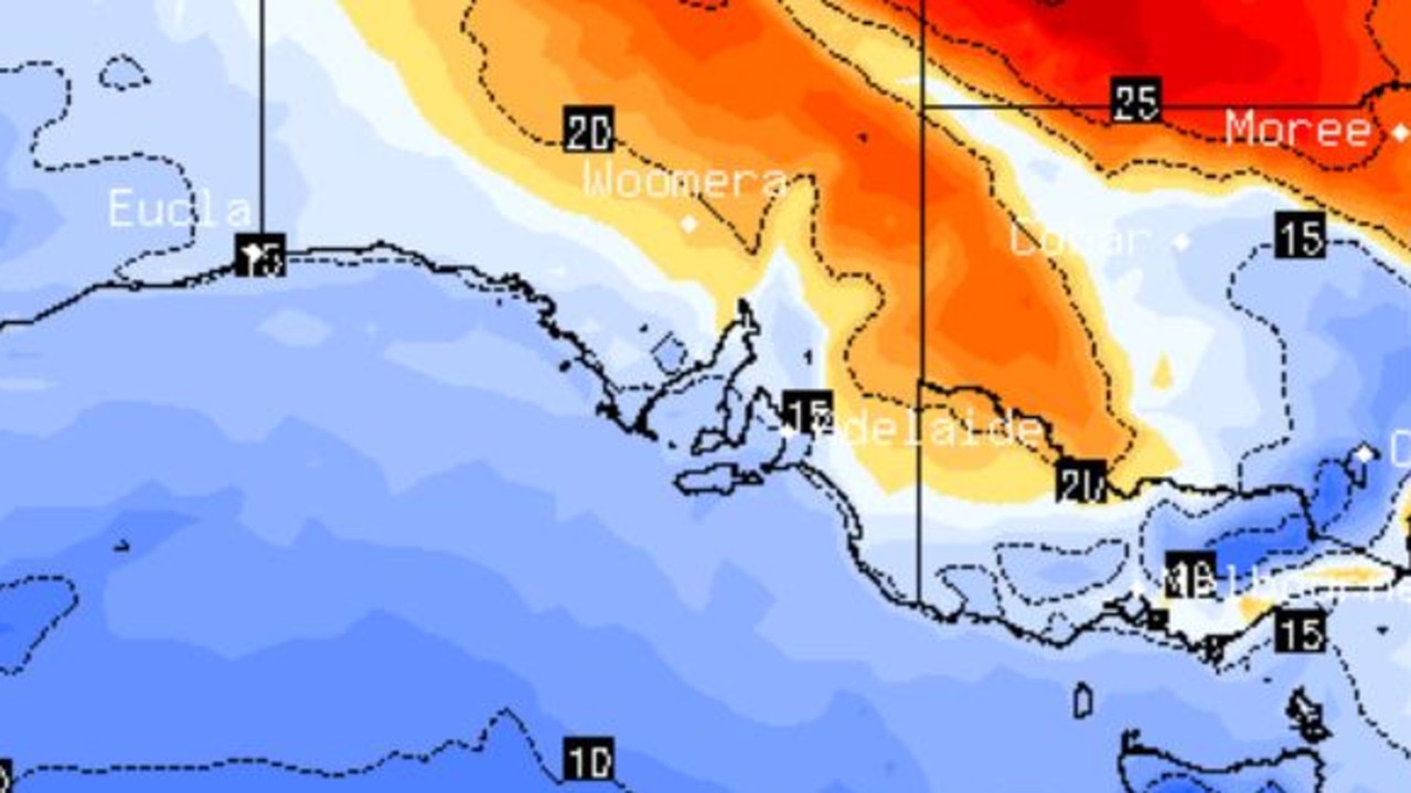
The cold snap sweeping the nation has torn through NSW, ACT, Victoria, South Australia and Tasmania, bringing fog, rain and snow to some regions.

Widespread fog blanketed five states on Monday, triggering a weather warning for SA motorists.

The road weather alert was issued early on Monday, saying there would be reduced visibility and potentially dangerous driving conditions in Adelaide and the Adelaide Hills.

In Victoria, meteorologist Dean Narramore said temperatures in Westmere, in the state’s southwest, nosedived to -1.4C, while other regions were hit with zero degrees.

“The high pressure system has moved in from late last week, which is giving Victoria in particular those cold mornings,” he said.

NSW and the ACT are bracing for snow over their southern ranges, with a chance of thunderstorms on the slopes later this week.

There’s a flood warning in the southern NSW town of Gundagai following the highest recorded overflow from the Yass River into the Burrinjuck Dam.

Water releases from the dam increased to 98,000 megalitres a day over the weekend following heavy rain in parts of the region.

Down south, Tasmanian residents are feeling colder than forecast temperatures due to the cold northwesterly winds hitting the state.

Hobart sat at 1.5 degrees on Monday morning, although the temperature feels-like dropped to -4C.

Alongside Adelaide, the state has also issued road weather warnings and urged motorists to drive to the conditions following thick fog.

The east coast of Tasmania could also experience minor flooding over the weekend, with a Tasman low likely to form and bring heavy rain.

Residents living in Queensland, NSW, ACT, Victoria, SA and Tasmania are expected to experience milder mornings after Wednesday.

.
Categories
Australia

NSW, Victoria, SA, Tasmania, ACT weather forecast: Severe weather warning

Severe weather warnings are in place in five states and territories as gale-force winds and thunderstorm conditions near a NSW ski resort.

Winds of up to 100km/h have hit NSW, Victoria and Tasmania early on Thursday.

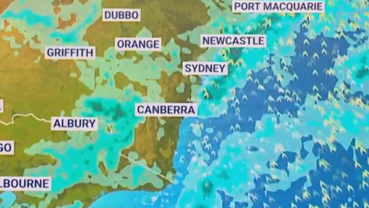
Canberra could see two months’ worth of rain fall in just 24 hours after 40mm of rain hit the ACT since midnight.

The cold front that whipped up damaging winds in Western Australia earlier this week has moved east across the Great Australian Bight overnight.

A complex low pressure system moving across the Great Australian Bight and an associated through and cold front are causing vigorous north-westerly winds across southeast NSW.

NSW and Victorian snowfields are set to suffer under a downpour of rain and gale-force winds, prompting Thredbo resort to close all lifts for the day.

Damaging north-westerly winds and dangerous surf are forecast throughout the day in South Australia, Victoria, Tasmania, NSW and the ACT, according to the Bureau of Meteorology.

Heavy rainfall is expected in some regions, and the bureau is monitoring the situation for isolated major flooding possible in catchments in southern NSW, northern Tasmania and Victoria’s northeast.

Sheep graziers across the south of NSW, ACT and parts of South Australia are warned that cold temperatures, showers and gusty winds are expected through Friday. There is a risk to lambs and sheep exposed to these conditions.

NSW/ ACT

Damaging wind gusts of more than 125km/h are likely for alpine areas above 1900m on Thursday.

Khancoban, behind Perisher Valley recorded a wind gust of 100 km/h at 2am while nearby Cabramurra recorded a gust of 98 km/h just after midnight.

The Snowy Mountains and South West Slopes could receive between 45mm and 60mm of rainfall.

Lightning and gale-force winds are expected throughout the day and have prompted Thredbo resort to shut down all lifts for the day to the disappointment of holiday-makers.

Just 22 of Perisher resort’s 53 lifts are open on Thursday and will continue to be monitored throughout the day for safety.

Inland water catchments are on flood watch as heavy rainfall across the central and southwest of the state could bring minor to isolated major flooding.

Saturated soils in the Central Tablelands and Illawarra will bring an increased risk of fallen trees and powerlines in powerful winds.

The west ranges of the ACT, east to Bombala, south to Crookwell and north to Oberon can expect damaging winds of up to 90km/h on Thursday morning.

South Australia

Strong to damaging winds smashed the western and southern coasts of the state on Wednesday afternoon.

They will return again on Thursday, bringing showers and thunderstorms to widespread areas of the south.

Up to 60mm of heavy rainfall is possible for parts of the Lofty Ranges into Thursday evening and Friday morning.

The area is on watch for a localized riverine or flash flood threat.

Victory

High-speed winds of up to 100km/h lashed the alpine regions on Wednesday and may return on Thursday.

Mt Hotham recorded 56.4mm in the 6 hours to midnight this morning.

Some parts of the state will receive up to 60mm of heavy rainfall throughout the morning, though most will average under 40mm.

A severe thunderstorm warning was canceled on Wednesday but conditions may return.

Rainfall of between 5mm and 10mm brought minor flood warnings for Seven and Castle creeks near Shepparton.

Tasmanian

Winds of up to 100km/h reached the state’s higher ground overnight and strong winds are expected to stick around through Thursday in coastal areas.

A minor flood warning is current for the Mersey, Meander, North Esk and Macquarie rivers.

Thunderstorms in the north and west of the state may drive more strong wind likes and higher rainfall totals.

Read related topics:Weather

.

Categories
Australia

Australia weather: BOM declares negative Indian Ocean Dipole, marking 60-year first

Australia’s wet patch will continue for months, a new finding reported by the Bureau of Meteorology suggests.

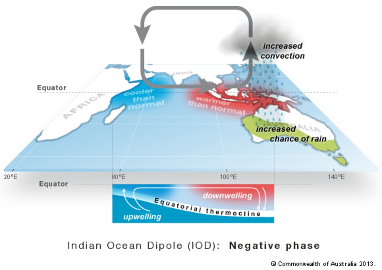
A negative Indian Ocean Dipole (IOD) has just been declared, meaning some serious wet weather is likely for large areas of the country throughout the rest of the year.

It is the second consecutive year we’ve had a negative IOD – the first time that has happened since the 1960s.

The IOD has three phases: neutral, positive and negative. Events usually start around May or June, peak between August and October and then rapidly decay when the monsoon arrives in the southern hemisphere around the end of spring.

The BOM reported the weather shift caused by a negative IOD could also have significant impacts on agriculture.

A negative IOD often results in cooler than average maximum temperatures over southeastern mainland Australia, while maximum and minimum temperatures in the far north of Australia are typically warmer than average.

Over half of the country on the east coast has roughly an 85 per cent chance of exceeding last year’s rainfall through spring.

‘Exceptionally dangerous’ conditions

A fierce double whammy weather system will lurch across Australia this week which in some areas will bring “exceptionally dangerous” conditions.

Huge waves, hundreds of millimeters of rain, flash flooding and gale force winds are all on the cards. And it won’t be a flash in the pan either with the slow moving system potentially lasting all week.

As many as six states could be hit with Western Australia and parts of Tasmania, Victoria and New South Wales particularly in the firing line.

“A prolonged period of wet and windy conditions will impact southern Australia this week as a series of powerful cold fronts sweep across the country,” said the Bureau of Meteorology’s Johnathan How.

“There is a very large mass of cold and unstable air over the Southern Ocean. And it’s this entire complex that will shift northwards and bring those wet and windy conditions to the rest of southern Australia.”

Sky News Weather senior meteorologist Tom Saunders said there were two key features with this system.

“Firstly, it’s slow moving so it will take the entire week to move from the south of Western Australia towards the southeast.

“So because of the slow movement of the system, it’s not just a few hours of severe weather for Western Australia – it’s three days.

“Secondly, it’s a strong system with strong to gale force winds”.

One front will move earlier in the week followed by another a couple of days later potentially bringing even more rain.

Adelaide was expected to see up to 10mm of rain on Tuesday with potentially damaging winds and thunderstorms for late morning onwards.

Rain will continue across much of the country on Wednesday, and then the front will come through on Thursday and Friday bringing up to around 25mm of rain over those two days.

A severe weather warning is in place for all of South Australia aside from the state’s north and extreme east around Remark. Damaging wind likes of up to 90 km/h are a possibility.

Mostly clear in Melbourne on Tuesday before the wind cranks up in the evening.

Showers can be expected for the rest of the week but the rain totals will be below 10mm each day.

In Sydney, showers are expected on Thursday followed by mostly sunny skies and 22C highs.

with Benedict Brook

Read related topics:Weather

.