Rain – Michmutters
Categories
Australia

Flood warnings as heavy rains fall across Tasmania

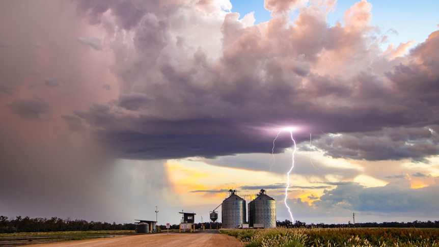
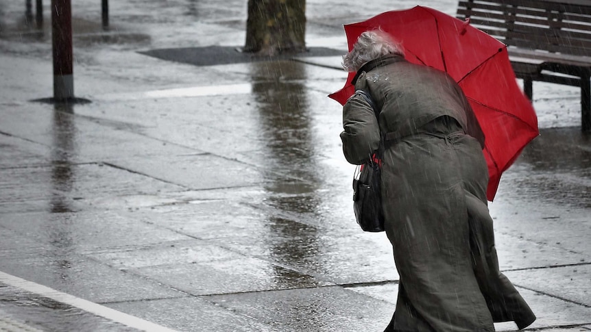
Heavy rains have brought flooding to parts of Tasmania, with flooded roads and emergency crews kept busy — but weather forecasters say the worst has passed.

Thousands of people were without electricity on Sunday morning, with Tasmania’s electricity utility TasNetworks reporting outages in Eaglehawk Neck, Highcroft, Koonya, Nubeena, Port Arthur, Premaydena, White Beach and surrounds “believed to be weather related”.

At 10am, the SES’s Leon Smith said there had been 40 call outs for “minor flood damage”.

“Things like water coming in through rooves, gutters overflowing, and water coming into homes.”

He said the calls starting coming from the northern suburbs and Greater Hobart area, but “as the system is moving south, crews are now active in the Huonville and Franklin areas.”

Mr Smith said there was “potential for thunderstorm activity”.

The SES will hold a press conference at 1pm today to update the situation.

Excavator machine in floodwaters, photo taken from a car.
A wet scene at Mountain River, south of Hobart.(Supplied: Kinnan Brightman)

The Bureau of Meteorology’s Deb Tabor said “certainly, the worst of it has happened.”

“But it will still be wet for the rest of the day, particularly in the east and south the winds will start to ease off, and they will get a little bit gustier in the afternoon on the east coast.

“Up to 9am this morning, the highest rainfall has been kunanyi/Mt Wellington at 109mm.”

Ms Tabor said there had been 91mm of rainfall at Nugent, 71mm at Mt St John, 68mm at Gray in the north-east, 67mm at Buckland and 56mm in Fern Tree.

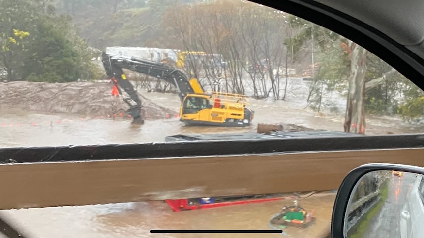
Water has cut roads in the flood-prone area of ​​Huonville, 38 kilometers south of Hobart, with Tasmania Police advising the Esplanade is closed due to water from the Huon River over the roadway.

Some residents have reported sandbagging their homes on Flood Road, with assistance from SES volunteers.

Tasmania Police are updating their list of road closures due to the weather.

In Baghdad, 37 kilometers north of Hobart, roads were flooded and residents watched as waterways swelled.

A resident in the town said the “rain was very heavy and the water came up really fast from the time I got up at seven till now”.

“We flood a bit in winter but this is crazy and seems to be getting worse every year.”

Space to play or pause, M to mute, left and right arrows to seek, up and down arrows for volume.
Heavy rains hit Tasmanian orchard at Grove

loading

A Cygnet resident said she had “not seen this kind of rain for about 17 years.”

“Last time it washed away our little water crossing at the bottom of our street, this morning it’s starting to overlap that crossing.

“It’s incredible how much water is coming down the creeks, our rain tanks were nearly empty yesterday and today they’re overflowing.”

Stay up to date with the latest warnings on the Bureau of Meteorology’s weather warnings for Tasmania website.

Aurora and Violet enjoy the wet weather.
Aurora and Violet could see the bright side of the gloomy weather in Huonville.(ABC News: Daniel Miller)

.

Categories
Australia

Southern Queensland weather forecast for another wet spring

Authorities and farmers in Queensland are preparing for a wet spring after a “nightmare” winter of rain and flooding.

The Bureau of Metrology this week declared the Indian Ocean Dipole was “negative”, which typically meant wetter than normal weather over winter and spring for much of southern and eastern Australia.

The bureau said there was also a chance La Nina could re-form for a third time during spring.

Condamine farmer Jake Hamilton said he was slightly concerned about the forecast after an “absolute nightmare” winter of muddy paddocks at his southern Queensland property.

Mr Hamilton said he had received more than 150 millimeters of rain in May, which severely delayed the planting of crops.

“We’ve had a 75-tonne snatch strap tied to the front of our planting tractor for the last three months, and it has certainly got a lot of use,” Mr Hamilton said.

“We’ve been bogging machines left, right and centre, whether it’s tractors or sprayers, just trying to get through the mud.

“I don’t think anyone in our area is going to want to go through a harvest that was as wet as the planting that we just had.”

A tractor in a muddy paddock
Tractors have been getting bogged down in wet paddocks. (Supplied: Jake Hamilton)

Mr Hamilton said the season overall had been as good as farmers could have hoped for.

But he said if the forecast for a wet spring did eventuate, it could exacerbate problems with plant diseases.

He said combined with a shortage of fungicides, it could result in significant crop losses.

“But at the end of the day, it is just a forecast,” Mr Hamilton said.

“We’ve had La Nina years where we’ve had little to no rain, so we can only just keep an eye on the short range and see what happens.

“But at least we are sort of preparing for it to be quite wet.”

A man with a beard standing in front of some crops
Jake Hamilton says he’s slightly concerned about forecasts of a wet spring.(Supplied: Jake Hamilton)

Authorities get ready

Authorities have also started preparations for a wet spring, with flooding in Queensland this year having already claimed more than 20 lives.

Dam operator Sunwater said 11 of its 19 reservoirs across Queensland were either at or close to capacity.

A lot of water rushes over a dam spillway
Leslie Dam at Warwick is one of the 11 dams at full capacity.(Supplied: Chris McFerran)

Sunwater executive general manager of operations, Colin Bendall, said communities needed to be vigilant if more early spring or summer rain was coming.

“Some of the preparation we’ve been doing is we conduct exercises with the local disaster management groups, and the Bureau of Meteorology,” Mr Bendall said.

He said staff were also being trained in the use of emergency action plans in the event of any further spills from dams.

loading

wet-summer

University of Southern Queensland climatologist Chelsea Jarvis said there was between a 65 to 80 per cent chance regions such as the Darling Downs would exceed their median rainfall.

She said scientists would continue to monitor the situation to see whether the Indian Ocean Dipole strengthened towards the end of the year.

“The end of this Indian Ocean Dipole event, whether it be October or December, can also determine how the likelihood of rain going into summer,” Ms Jarvis said.

“The second thing I’d be looking out for is what’s going on in the Pacific Ocean with this La Nina event, it’s just sort of hanging out there.”

.

Categories
Australia

NSW and Victoria weather forecast predicts rain, winds and floods

The weather is expected to keep getting wetter for inland NSW and Victoria’s alpine regions today as the biggest frontal system of the season sweeps through.

The complex low pressure system is not being followed by the usual piercingly cold change, which is great news for those who are sick of shivering but a worry for the ski fields.

Why all the wild weather?

The first in a series of cold fronts moved through Western Australia on Monday, where some Perth suburbs were hit by their highest wind gusts on record and power outages caused havoc at the airport.

loading

The next swept across South Australia on Tuesday.

Today a third is sweeping across the south-east.

“That’s going to tap into some tropical moisture, leading to widespread rainfall across much of inland New South Wales and north-eastern parts of Victoria,” weather bureau meteorologist Dean Narramore said.

“The main band will really start to pick up on Thursday morning and then become widespread across New South Wales and north-eastern Victoria Thursday afternoon and Thursday night.”

He said the heaviest falls were expected west of the Great Dividing Range.

Map of Australia green over southern states indicating rainfall expected
Heavy rain is expected over the next few days.(Supplied: Bureau of Meteorology)

“This is more of an inland rain event,” Mr Narramore said.

loading

He said more than 100 millimetres of rain could fall on Victorian alpine regions today.

“That could lead to minor to moderate flooding on some of our rivers, creeks and streams,” he said.

“So something to watch as you move through later into Thursday into Friday.”

Rain is also expected to continue over northern and western parts of Tasmania, where flood warnings are also current.

Wind impacts are not expected to be as bad as in the past few days.

But Mr Narramore warned likes of about 100 kilometers an hour were still likely through north-eastern parts of Victoria, particularly for alpine areas.

He said elevated parts of New South Wales were also at risk of strong winds, with likes of up to 125 kilometers an hour predicted in the Snowy Mountains.

Watch for warnings

Victoria State Emergency Service chief officer of operations, Tim Wiebusch, urged people to keep up with emergency information.

“Ensure you listen to the advice of emergency services, and secure loose items in and around your home, park your vehicle undercover, away from trees and remain indoors until the severe weather has passed,” he said.

“As we are expecting heavy rain in parts of Victoria, it’s important you never drive through floodwater.

“Attempting to drive through flood waters may be the last decision you make,” he said.

Bad news for the snowfields

Cold fronts are usually followed by a blast of icy southerly air. But this time around temperatures have remained remarkably balmy.

.