Australian Weather News – Michmutters
Categories
Australia

Floods, storms and destructive winds set to smash parts of Australia

Floods, destructive winds and thunderstorms are expected to smash large areas across Australia’s south east as wild weather moves across the country from Western Australia on Thursday.

Wild conditions have already lashed much of southern Australia, uprooting trees and sending thousands of homes into darkness as the destructive conditions caused blackouts.

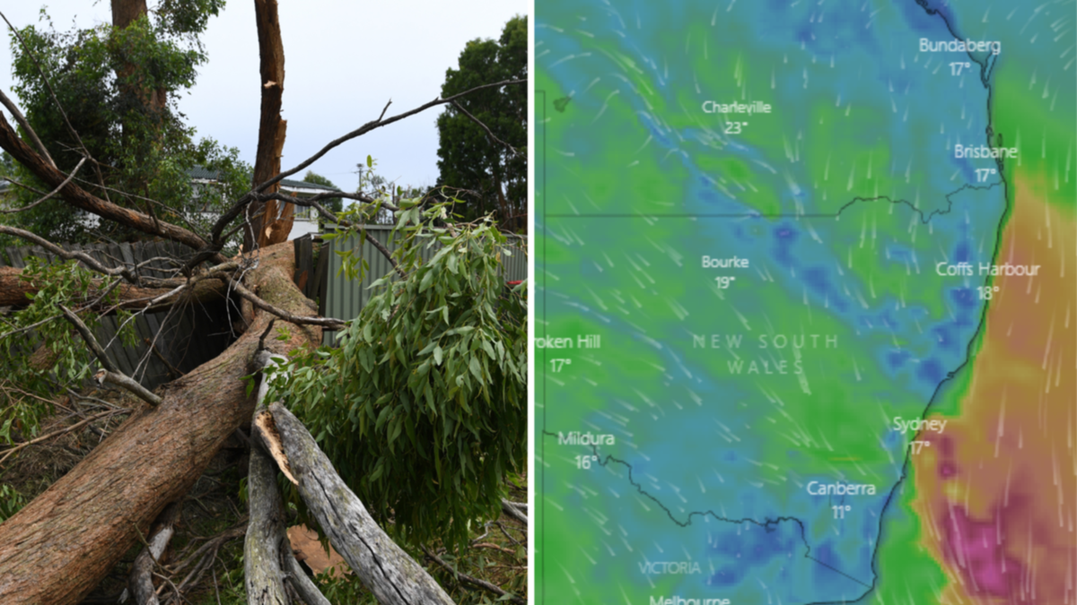
Watch more storm damage in the video above

Watch the latest News on Channel 7 or stream for free on 7plus >>

But the Bureau of Meteorology says little relief is on the way, with severe conditions expected to smash the country’s south east again as a second cold front moves in, with WA, SA, NSW, Victoria, and Tasmania in the firing line.

“Flooding rain, thunderstorms and dangerous winds will spread over southern and southeastern Australia during the next two days, with warnings in place for several states,” Weatherzone Meteorologist Ben Domensino said on Wednesday.

“A series of cold fronts and low pressure troughs are sweeping across southern and southeastern Australia this week as a large and complex low pressure system passes to the south of the country.”

The destructive conditions forced Perth Airport to use a back-up generator on Tuesday evening, after a high-voltage transmission pole was damaged.

The chaos plunged the airport into darkness as flights were delayed and canceled and frustrated travelers were left stranded.

Wild weather caused the ceiling of this Perth home to collapse. Credit: 7NEWS
Trees were leveled across much of southern Australia as wild winds continued. Credit: 7NEWS

The damaging winds were felt across the country, with VIC SES receiving 399 calls for assistance in the 24 hours to midday Wednesday, mainly over fallen trees.

Meanwhile, emergency services in WA answered more than 440 calls for help since Tuesday afternoon and another 51 in the 24 hours to Tuesday night and 10 on Wednesday morning for SA SES.

Wind gusts hit a whopping 120km/h in WA on Wednesday morning at Cape Leeuwin, meanwhile SA’s Neptune Island recorded the state’s peak of 104km/h.

Mount William in Victoria was smashed by winds of up to 122km/h and NSW experienced its highest gusts of up to 107km/h at the snow mountains.

Wild weather to come

Looking ahead, BOM is warning damaging winds and dangerous surf are likely to hit SA, VIC, TAS, NSW and the ACT, as windy conditions finally ease in WA.

A second in a series of cold fronts will move through southern Australia on Thursday and is expected to bring heavy rainfall and potential flooding for northeast Victoria and south-east NSW, meteorologist Dean Narramore warned.

“Last night we saw a very strong cold front move through South Australia and Victoria and that brought damaging winds to numerous locations,” he said.

“But it is this next cold front that has got a link to tropical moisture that is really going to bring our heavy rainfall threat as we move into tomorrow.”

Trees down in Victoria. Credit: 7NEWS

Winds were expected to temporarily ease in SA on Wednesday night before re-intensifying on Thursday, with a severe weather warning in place for damaging winds across most districts.

Locations which may be affected include Adelaide, Port Lincoln, Whyalla, Mount Gambier, Ceduna, Port Augusta, Port Pirie, Clare, Maitland, Murray Bridge, Kingscote and Naracoorte.

Damaging winds are set to re-develop over the eastern ranges in VIC on Wednesday night, with heavy rainfall expected on Thursday.

A severe weather warning is in place for parts of East Gippsland, North East and West and South Gippsland Forecast Districts, and a flood watch has been issued for parts of the state’s northeast.

In NSW, damaging winds will continue over the south east, with gusts stronger than 125km/h likely to continue for alpine areas.

Lashings of rain which may lead to flash flooding could develop across the Snowy Mountains and the South West Slopes from early Thursday morning and the northern parts of the Central Tablelands from Thursday afternoon.

A flood watch is current for inland NSW central and southwest catchments.

Winds of up to 90km/h are expected in TAS, as VIC expects dangerous likes of 110 to 130km/h.

Scuba diving robot searches for sunken treasure.

Scuba diving robot searches for sunken treasure.

.

Categories
Australia

Victoria, SA, WA and NSW weather update: Wild weather batters large swathes of Australia with much more on the way

Large swathes of South Australia, Victoria and Western Australia were battered by wild winds overnight on Tuesday, leveling trees and leaving homes without power, with no reprieve expected until Sunday.

Potentially destructive winds have been forecast for much of southern Australia as a series of cold fronts moves across the country.

Severe weather warnings are current for parts of WA, SA, NSW and Victoria, as several locations gear up for a trifecta of damaging winds, heavy rainfall and flooding.

Watch the latest News on Channel 7 or stream for free on 7plus >>

In NSW the BOM is warning of damaging winds and heavy rainfall across the Illawarra, South Coast, Southern Tablelands, South West Slopes, Snowy Mountains and Australian Capital Territory forecast districts.

Blizzard conditions are possible in Alpine areas above 1900m, and the BOM is also warning of damaging wind gusts up to 90km/h in the state’s west.

The Victorian SES received 216 calls for assistance in the 24 hours to 6am Wednesday, mainly over fallen trees.

The busiest volunteer units were Emerald (24 calls), Pakenham (19) and Upper Yarra (15), with about 17,000 households in the Emerald and Pakenham areas without power.

VIC SES chief officer of operations Tim Wiebusch told Sunrise only a small percentage of trees had fallen onto structures.

“The problem has been trees across the road, and so I can’t emphasize enough this morning, be cautious, be alert to conditions when driving to work,” he said.

Trees down in Victoria. Credit: 7NEWS
SES crew clear up trees that have fallen near properties and on roads in Victoria. Credit: 7NEWS

Watch and act warnings have been declared for The Great Dividing range, with residents in the area urged to prepare to take shelter.

However, the severe weather warning for Central Highlands and Mount Dandenong has now been cancelled.

Gusts in the Grampians reached almost 110km/h overnight, with Melbourne’s northern suburbs expected to be hit with wild winds later today.

Damaging winds averaging 65km/h with peak gusts up to 110km/h are occurring over elevated areas of Victoria’s eastern ranges, which are expected to ease on Wednesday afternoon.

However destructive gusts are expected to re-develop in the southwest of Victoria during Wednesday evening, with wind speeds averaging 50-60km/h expected and peak gusts of 90km/h.

Heavy rainfall is predicted in coming days across much of southern Australia. Credit: BoM

WA SES was called to 345 jobs in the past 24 hours to 6:30am Wednesday morning, 300 of those in the metro area.

Damage has occurred from Butler in the north of Perth to Mandurah on the southwest coast.

Most calls were related to fallen trees on roofs, damaged power lines, with some reports of patios and verandahs being ripped from homes.

There has also been one report of a roof that has collapsed in Joondalup.

According to the Bureau of Meteorology, a series of vigorous cold fronts will continue to cross the south of WA through to early Thursday.

Gusty showers and thunderstorms are likely along these fronts, as well as in the westerly flow in their wake.

Those in the Goldfields-Midlands, Midwest-Gascoyne, Perth Metropolitan, South West, Lower South West, Great Southern have been warned to take action.

South Australia’s SES received 51 call outs in the 24 hours up until Tuesday night, with another 10 received on Wednesday morning.

Most were pertaining to fallen trees, however none have created any significant damages to property.

SA SES told 7NEWS.com.au the state was not hit as hard as it was initially forecast.

SA Minister for Human Services Nat Cook has announced a code Blue has been introduced from Wednesday across the metro Adelaide due to the weather, meaning homelessness services will visit known rough sleeper locations to make people are aware of available support.

“Code Blue continues in regional centers until 9 August in the Riverland, Limestone Coast, Victor Harbor, Kangaroo Island, Port Lincoln, Clare, and Kadina,” she wrote on Twitter.

Strong to damaging northwesterly winds averaging 50-65 kilometers per hour with peak gusts of around 90km/h, are still possible across parts of the warning area during Wednesday afternoon and early evening.

The risk of severe winds will ease Wednesday evening, but conditions will remain comfortable near some coastal areas throughout the night.

Conditions are expected to ease across southern Australia this Sunday.

Scuba diving robot searches for sunken treasure.

Scuba diving robot searches for sunken treasure.

.