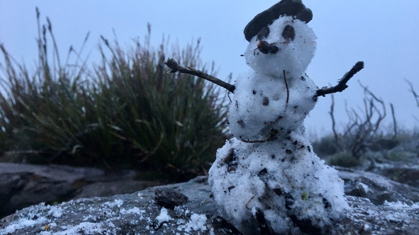
A wintry mix of hail, blustery thunderstorms and even snow flurries is on the cards for Western Australia, as the south-west corner of the state, including Perth, braces for what could be its coldest day of the year so far.
Key points:
- Temperatures are expected to plummet in WA’s South West on Tuesday
- The weather system could also bring strong winds and hail to parts of WA
- Bluff Knoll in the Stirling Ranges could get a dusting of snow
A gusty cold front reached Perth just before midday on Monday, and is set to sweep over the remainder of the South West Land Division, reaching Geraldton to Hopetoun this evening.
While this event is not likely to be as strong or prolonged as the system that hit WA last week, causing record wind gusts in some places, it is still expected to pack a punch.
Cape Leeuwin and Ocean Reef have already recorded wind gusts nearing 90 kilometers per hour.
Hail could impact large swathe of state
Bureau of Meteorology senior forecaster Caroline Crow said the initial cold front would be followed by a pool of cold air on Tuesday, which would send maximum temperatures plummeting and bring hail to a large area of the state.
“Coming into tomorrow there will be potential hail though the South West Land Division from about Jurien Bay to Lake Grace to Esperance,” she said.
“Broadly speaking, it’s the coldest outbreak for the south-west of the state that we’re looking at for this season so far, given the region of hail potential which is quite far inland.”
She said maximum temperatures would generally be between two and six degrees Celsius lower than average on Tuesday, with temperatures in the Great Southern region struggling to reach the low teens.
“The Great Southern and south coastal district is looking at temperatures around 10C to 12C,” she said.
“And from Bunbury into inland parts of the South West Land Division, all the way to the south-east coastal district around that 12C mark.”
Perth is also forecast for cooler-than-normal weather, with a maximum of 15C expected in the city and 14C in Mandurah.
The coldest day of the year so far in Perth was on July 17, when the temperature peaked at 14.2C.
In Katanning, the coldest day was on July 30 when the mercury reached just 11.1C, Mount Barker’s chilliest day was on August 3 (11C) and Bunbury’s coldest day was on July 30 (13.9C).
Bluff Knoll could get more snow
Ms Crow said the cold blast could mean snow on Bluff Knoll, in the Stirling Ranges, for the second time in a fortnight.
loading
“It might get cold enough tomorrow to see a little bit of snow up Bluff Knoll, early in the morning around 4am to 5am through until midday,” she said.
“It’s more likely to be flurries rather than really settling on Bluff Knoll.”
One weather app, Windy, has even forecast the chance of light snow on the Perth Hills early on Tuesday. However Ms Crow said that was unlikely.
“The darling scarp doesn’t have a freezing level low enough or cold enough to get a dusting of snow like Bluff Knoll,” she said.
‘Unseasonal’ rain for northern parts of WA
It’s not just the south of the state expecting a wintry blast.
Ms Crow said a band of cloud was starting to thicken up over western Pilbara and central WA, which would likely bring showers by mid-week.
“Come tomorrow, we will start seeing the potential for showers and patchy rain out of it,” she said.
“And then coming into Wednesday the eastern parts of the Pilbara and into the interior could get falls of 10 millimetres, with isolated showers up to 20mm.”
Ms Crow said the showers were unusual for this time of year, with the north of the state currently in the middle of its dry season.
She said there would also be cool temperatures for the region.
“It looks like underneath that cloud, band temperatures could be four to eight degrees below average,” she said.
Miserable weather forecast for Perth
- Tuesday: Min 7C, Max 15C, Very high chance of rain
- Wednesday: Min 7C, Max 18C, High chance of rain near the coast
- Thursday: Min 5C, Max 18C, Partly cloudy
- Friday: Min 7C, Max 20C, Mostly sunny
- Saturday: Min 11C, Max 20C, Very high chance of rain
- Sunday: Min 11C, Max 21C, Very high chance of rain
.

