flood water – Michmutters
Categories
Australia

As floodwaters hurtled towards Lismore, several rain and river gauges stopped working

Residents living upstream from Lismore say faults in the rain and river gauge network deprived them of potentially life-saving data as a catastrophic flood hit the New South Wales Northern Rivers in February.

There are 27 rainfall and 19 stream level gauges in the Wilsons River catchment that provide data to the Bureau of Meteorology to help predict flood heights and develop forecasts.

Residents also monitor the data directly via the bureau’s website.

When the February flood hit, one rain gauge was already broken and a further two rain gauges and six stream gauges stopped transmitting data during the event.

ABC’s 7.30 can reveal that crucial equipment failed because it was poorly located, while key rainfall data was missed or distorted due to a lack of maintenance.

A green pole with an antenna attached.
When the February floods hit the Northern Rivers, one rain gauge was already broken and two more stopped transmitting data.(abcnews)

The revelations follow the release of a NSW parliamentary report examining the flood response, which found information from the Bureau of Meteorology was “incorrect and out of date”, and called for the bureau to review its rain data infrastructure to ensure rain and flood gauges were appropriately placed, maintained and updated.

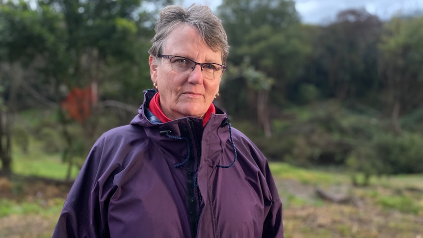
Local resident Annie Kia says the failures of the gauge network caused “much distress” among her upstream neighbours, who were among the first to witness the scale of the disaster firsthand.

“The upstream people knew that a catastrophe was hurtling toward Lismore in the night, and felt very frustrated that they could not get their message across,” she said.

‘People downstream really need to know’

A woman stands outside wearing a blue jacket.
The gauges near Nan Nicholson’s home stopped working as floodwaters rose.(ABC News: Ella Archibald-Binge)

Nan Nicholson’s property is nestled in the hinterland north of the town, flanked by two creeks that feed into the Wilsons River catchment.

“If it’s torrential rain up above, we know that Lismore is going to really cop it,” she said.

As a low pressure system moved south on the night of February 27, she was keeping a close eye on the local rain and stream gauge data, which she and her neighbors rely on for real-time information to decide when to evacuate.

The stream gauge said the nearby creek was “steady.”

However, that was in stark contrast to what was unfolding in her backyard: The creek was rapidly closing in on her home, and the hammering rain showed no signs of easing.

She could see the flood was shaping up to be far worse than initial predictions of a peak around the 2017 height of 11.59 meters.

Water flows over rocks.
Rocky Creek, one of the feeder creeks upstream from Lismore.(ABC News: Ella Archibald-Binge)

“You could watch it within the minute rising very, very rapidly, so I just didn’t believe [the data]and that really filled me with dread,” she said.

“I thought, ‘People downstream really, really need to know this, and they’re not getting that information’.”

Ms Nicholson and her husband made a narrow escape in the night.

By the time they left, the nearby river gauge was not transmitting any data at all.

The rain gauge failed a short time later.

“Because of our knowledge of the area, we felt prepared to some degree, but it would have helped a great deal to know that that river gauge … was telling the truth,” she said.

“It’s a basic government responsibility to deliver us the data that we need to make decisions about our survival.”

‘Whole network needs to be reassessed’

A man standing outside wearing a cap, a blue top and a black padded vest.
Duncan Dey says rainfall modeling “only works if you’ve got good data”.(ABC News: Ella Archibald-Binge)

Duncan Dey is a flood hydrologist and Byron Shire councilor who used to install and maintain rain and stream gauges.

I have identified key flaws in the gauging station near Ms Nicholson’s property.

He said a shed housing equipment that sends data to the weather bureau should have been located on higher ground.

“We know that the shed went underwater, and I’m stunned, actually, because it went underwater by three or four meters, which means that it was wrongly located in the first place,” he said.

“The whole network needs to be reassessed for whether the machinery shed is high enough above the flood levels.”

A man and woman stand next to a rain gauge which looks like a green shed.
Duncan Dey and Annie Kia inspect a rain gauge. Mr Dey was surprised to find a tree growing over the top.(abcnews)

Mr Dey said he was also “shocked” to see a tree overhanging the top of the rain gauge.

“So it’s not actually measuring the right amount of rain. It’s completely non-standard,” he said.

“We now have computer modeling that works really well on taking rainfall, putting it into a catchment and working out what happens downstream — the modeling is fantastic, but it only works if you’ve got good data.”

A BOM spokesperson said the outages did not impact the bureau’s forecasts and warnings during the February flood, and that redundancy has been built into the observation system.

However, the bureau is reviewing its infrastructure across the catchment.

Council requests more gauges

man in tweed jacket
Lismore City Council general manager John Walker says the gauges are maintained every three months, or more often if a fault occurs. (ABC North Coast: Bruce MacKenzie)

The state gauge network is jointly managed by local, state and federal governments, along with some private agencies.

Lismore City Council owns the gauges that malfunctioned in February.

General manager John Walker said all but two of the gauges have been fixed, with parts on order from overseas, while one was broken prior to the flood because a technician could not get access to the site due to ground conditions.

Mr Walker said all existing gauges were located above the 1974 flood levels and the equipment that had been repaired has been relocated to higher ground, above the 2022 flood height.

He said the gauges were maintained every three months, or more often if a fault occurs.

The council’s request for more gauges, he said, was being assessed by the NSW Planning and Environment Department, after it was initially rejected in February.

A spokesperson for the department said it was awaiting completion of the council’s flood plain management plan before it could review the funding application.

Resident Annie Kia is among many — including local councils and MPs — calling for a single agency to own and maintain the gauge network.

“It’s clear to me that the system is not fit for purpose,” she said.

“We need to have some government system that manages these creek and rain gauges, and it seems to me it would be better if it was one agency — as long as it’s one, competent agency.”

Watch this story on 7.30 on ABC TV and ABC iview.

.

Categories
Australia

Outback in bloom as floodwaters travel hundreds of kilometers into Kati Thanda-Lake Eyre

It’s a special time in the outback and deserts of central Australia.

For many tourists, it is not the dust bowl they had in mind.

a woman bends down close to photograph a wildflower in the middle of a dry red landscape
It’s hard to imagine the variety of wildflowers in these arid landscapes and Zippy says it’s blown her mind.(ABC Western Qld: Carli Willis)

Cairns local Zippy Warnecke is currently traveling through the region.

“When you think of the desert, you don’t expect any life to be there, but it’s full of it at the moment; flowers, animals — the whole lot,” she said.

Across large parts of outback Queensland and the Kati Thanda-Lake Eyre Basin, unseasonal Autumn rain has left carpets of wildflowers and greenery.

“It’s not at all what I imagined — it’s so much better,” Ms Warnecke said.

Two children wearing bright pink shirts star jump surrounded by bright yellow flowers.
Wildflowers have emerged from the arid landscapes after recent rains.(Supplied: RLR Photography)

Months in the making

Floodwaters from rain months ago have moved through free-flowing rivers in the Channel Country into the illustrious Kati Thanda-Lake Eyre in northern South Australia.

An aerial view of a flock of pelicans landing on a body of brown water.
Flooding transforms arid landscapes into rivers teeming with birdlife like pelicans.(Supplied: Wrights Air)

“This is just an amazing time when these floods start going down these big Channel Country rivers,” said University of New South Wales professor of environmental science Richard Kingsford.

“Lake Eyre gets water every couple of years, but a really big filling doesn’t happen that often.

“In terms of surface area, probably 70 or 80 per cent of Lake Eyre has water in it … that’s a pretty rare event.”

A satellite image shows Kati Thanda-Lake Eyre full with a blue body of water in the middle of desert country.
Satellite view of Kati Thanda-Lake Eyre in late July, 2022.(Supplied: Digital Earth Australia)
Satellite view of a dry Lake Eyre on January 9, 2022.
Satellite view of a dry Kati Thanda-Lake Eyre on January 9, 2022.(Supplied: SentielHub)

Hundreds of kilometers from any coastline, the Lake Eyre Yacht Club has seen members and tourists take to the waters of the Warburton River, which feeds into Kati Thanda-Lake Eyre.

“That is an adventure in its own right. It’s a 440km return trip from where we launch,” Commodore Bob Backway said.

“When you get to the lake you can sail about 6km before you run aground.”

Pilots are reporting an increase in inquiries and bookings to see Kati Thanda-Lake Eyre and surrounding river systems while conditions are “spectacular”.

A plane flies over Kati Thanda lake Eyre and the water is hues of pink and blue against a blue sky and white clouds.
As Kati-Thanda-Lake Eyre begins to fill, the color of the water changes.(Supplied: Wrights Air)

“We’re starting to see lots of people plan their trips out now and the plans are going to Lake Eyre every day,” said Birdsville Aviation senior pilot Talia Ellis.

“Lake Eyre is over 170km north to south. People are absolutely gobsmacked at the sheer size of it.

“We give people perspective from down low so you can see the bird life—there are pelicans nesting on islands.

“We also give people the perspective from higher up as well, so they’ve got the perspective to pin it against the rest of the landscape.”

Water ‘a tonic’ for desert stations

Water flooding through an outback creek way creates intrinsic patterns through a brown landscape and green growth emerges around
Nappa Merrie station typically sees low rainfall and relies on Cooper Creek flooding.(Supplied: Nappa Merrie station)

At Nappa Merrie station on the SA border, Cooper Creek flooding has been vital.

The station relies on the flooding to grow feed for 11,000 cattle and to fill the 30,000-gallon (136,382-Litre) tank that provides running water to the family household.

“Just the last Christmas we were battling along with a few waterholes going dry and then we got a run in the river,” said station manager Peter Degoumois.

“It means a lot, really.

“It’ll hold us over summer pretty well and you can carry a lot of cattle.”

A man with gray hair and a blue shirt sits in front of an outback waterhole looking at the camera.
Richard Kingsford is a river ecologist and conservation biologist.(Supplied: UNSW)

Professor Kingsford, who has been researching the Kati Thanda-Lake Eyre Basin for decades, said there was a shift in community morale when the rivers were watered.

“It really is a fantastic tonic for those times of drought, which are really tough and getting tougher with climate change,” he said.

An aerial view of the greenery carpeting Cooper Creek.
An aerial view of the greenery carpeting Cooper Creek.(Supplied: Air Central West)

Researchers galore

Associate professor Tim Cohen from the University of Wollongong is a desert beach hunter on a mission to track the major lake-filling events of the past millennium.

The “double-dip” La Nina pattern has primed the landscape to trace weather extremes back to 10,000 years ago.

Space to play or pause, M to mute, left and right arrows to seek, up and down arrows for volume.
The water finding its way to Kati Thanda-Lake Eyre supports an abundance of life(Supplied: Timothy Cohen)

“I think one of the most exciting things we have discovered on this last field trip was… evidence of events as large, or larger than, 1974 in the recent past,” Mr Cohen said.

“We know there are cycles that drive drought and floods and by understanding how these manifest across the continent, we can see how anthropogenic global warming is influencing that.”

A recent aerial view of the edge of Belt Bay of Lake Eyre.
A recent aerial view of the edge of Belt Bay at Kati Thanda-Lake Eyre.(Supplied: Moshe Armon/ETH Zurich)

To the north of Kati Thanda-Lake Eyre, the Kalamurina Sanctuary — a reserve at the intersection of three of Australia’s deserts — has been the location of a recent bird survey.

“The biggest benefit to the birds we found this survey is the rain we had earlier in the year,” said wildlife ecologist Keith Bellchambers.

“[We found] a lot of the smaller boom-and-bust species … we’ve had big flocks of diamond doves, zebra finches, budgerigars [and] cockatiels.

“Things like that have just increased enormously in number in the last six months just because of the food resources they’ve been able to find following that rain.

“It’s visually spectacular, but it’s also a spectacular soundscape.”

.