The weather set-up is classic for a late summer line of severe thunderstorms Wednesday.
All of the boxes of basic items on a severe weather checklist are checked for afternoon Wednesday and evening. Heat and high humidity will create unstable air. Unstable air rises and produces billowing thunderstorms. The engine to a large line of thunderstorms is an upper-air disturbance and an abrupt wind shift at the surface. Both of those storm-making weather features will be present late Wednesday. Finally, the time of day matters for robust storms. The heat of late afternoon and evening are the right time for scattered thunderstorms to merge into a solid line of thunderstorms.
The Storm Prediction Center’s early Tuesday morning severe weather forecast for Wednesday afternoon and evening indicates the severe weather should occur over part of Lower Michigan.
The severe storms are expected from the Alpena area through Bay City, Saginaw, Midland, the Thumb, Flint, Lansing and possibly the Grand Rapids area. The placement is based mostly on the peak instability of the day from 3 pm to 10 pm

Overall severe weather probability for Wednesday afternoon and evening, August 3.
The Storm Prediction Center mentions that widespread tornado development is not expected, but an isolated tornado is possible.

Isolated tornado probability for Wednesday afternoon and evening, August 3.
Typically these lines of thunderstorms produce one-mile wide segments of 60 mph winds, or maybe even slightly stronger. The damaging wind like forecast shows the area where the storms will be located during the late afternoon and evening.

Damaging wind like probability for Wednesday afternoon and evening, August 3.
They also give a small chance of large hail occurring in any of the thunderstorms across Lower Michigan.

Large hail probability for Wednesday afternoon and evening, August 3.
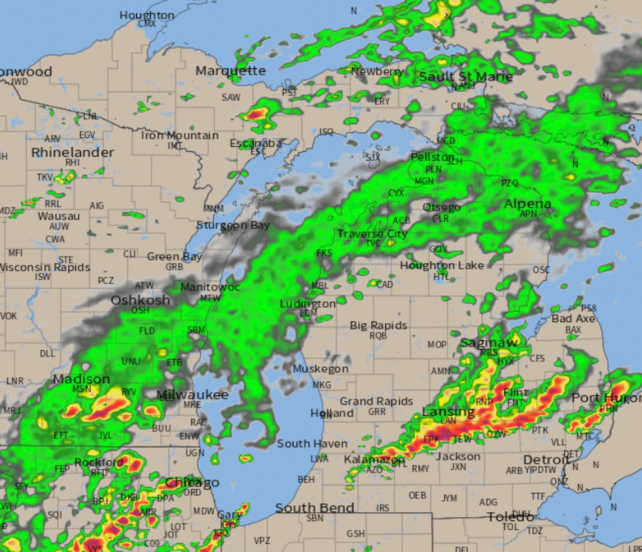
Here is the radar forecast from the best model for this situation and the 24 hour to 36 hour timeframe (from Tuesday morning).

Radar forecast from midnight Wednesday, August 3 to 6 am Thursday, August 4.
The weather scenario gives us a pretty easy concept on when and where to prepare for possible severe thunderstorms Wednesday afternoon and evening. The line of storms will likely move from the northeast corner of Lower Michigan to the Saginaw Bay area, and could even hold together into southeast Lower Michigan. The severe part of the line of storms may extend back to the southwest into the Grand Rapids area.
Also note that an early morning line of thunderstorms could bring a burst of severe wind gusts across the northern part of Lower Michigan. This line of storms would be a different line of storms than the afternoon storms.
If you have a construction project that is susceptible to wind damage or heavy rain damage, make sure to protect it today. If you are planning some boating, Wednesday will probably be too windy before the storms and then obviously too dangerous during the storms. Campers will just need to be ready to move to a sturdy vehicle or solid building for the hour when storms are moving over your campsite.