River – Michmutters
Categories
Australia

Great Australian Platypus Search removes guesswork for scientists in Victoria

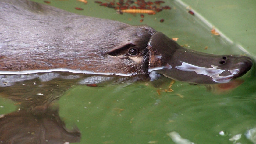
The results are in from an audacious search that’s been described as part CSI, part Where in the World is Carmen Sandiego?

If Carmen Sandiego was a platypus and not a computer video game character from the 1990s, that is.

For the first time, thanks to The Great Australian Platypus Search, Victoria has a statewide picture of how its platypus population is faring.

The search was held from August to September last year, with citizen scientists asked to collect water samples from more than 1,500 waterways across the state.

Scientists at EnviroDNA ran those water samples through their labs searching for environmental DNA, also known as eDNA.

The eDNA contained traces of wildlife DNA shed from the animals into the environment.

Ember emerged from her borough just after the Victorian bushfires.
The platypus is an Australian icon and an important indigenous species.(Healesville Sanctuary)

Scientists used the information to genetically trace some of the state’s stealthiest critters into previously unknown hideouts.

“I don’t know if it’s exciting, but filling in areas where we didn’t have platypus data before was one of the big goals of the project,” said platypus ecologist Josh Griffiths.

“The results were largely what we expected — the platypus were largely where we thought they were, and not where they weren’t thought to be.”

But that didn’t mean all was well for one of Australia’s most unique mammals.

The platypus was listed as threatened for the first time in Victoria last year, and was endangered in South Australia.

An EnviroDNA spokesperson said the data from the project would be released to the public soon, and that a similar program was expected to start in New South Wales in the near future.

A map showing thousands of points across Victoria that have been tested
Water samples were taken from more than 1,500 waterways as part of the Great Australian Platypus Search.(Supplied: EnviroDNA/Google Maps)

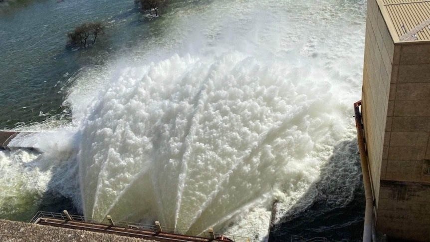
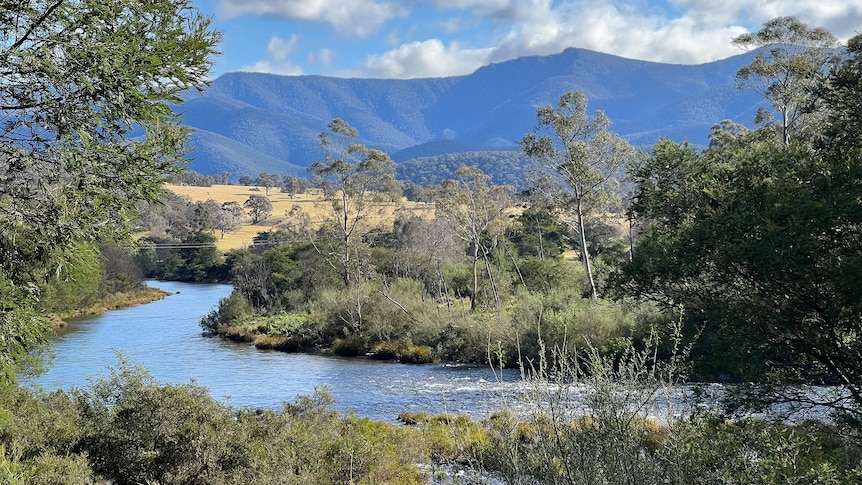
victorian rivers under microscope

The platypus search turned Victoria’s waterways into a quasi-crime scene, with amateur sleuths slugging through the bush taking samples that would hopefully uncover vital clues.

Early results indicated promising returns in western Victoria, particularly in the Wimmera region.

“There was a localized population in the Mackenzie River and it looks like that population is expanding a little bit further which is great,” Mr Griffiths said.

“We’ve found them as far downstream as we’ve seen in decades.”

A gloved hand holding a small syringe
DNA samples were collected using an array of equipment, including this syringe pictured at the Hopkins River in Warrnambool.(Supplied: EnviroDNA)

Further south-west near Warrnambool, strong numbers were recorded in the Glenelg and Hopkins Rivers, however there were no platypuses found in smaller tributaries off those major rivers.

“One of the big things to come out of this is to find where those populations are that are in strife,” Mr Griffiths said.

“That way we can find out where we can best assist the population so that they’re still around in another 50 or 100 years.”

What can be done?

The survey was spearheaded by a not-for-profit conservation organization the Odonata Foundation, with funding from the state government and numerous philanthropists.

It was hoped the results would be a baseline for future generations’ learning.

“To have a statewide, point-in-time snapshot of Victoria’s platypus populations is really special,” said Odonata Foundation CEO Sam Marwood.

A woman wearing a science lab coat testing a water sample for DNA
Information analyzed by scientists will be invaluable for catchment authorities and those charged with protecting the state’s waterways.(Supplied: Rachael Dere (Blue Tree Studios) and Amicus.)

“This data will complement many years of visual observations and scientific studies, to give us the most comprehensive understanding of platypus distribution we have ever had.”

Mr Griffiths said the information would be invaluable for catchment authorities and those charged with protecting the state’s waterways.

And just as citizen scientists collated the information, they could also help to stop the population decline.

“The number one thing is trying to be careful with our water,” Mr Griffiths said.

“When we went through the drought everyone was very conscious about conserving water, but I think it’s probably been a bit slacker since.

“Every time we have a shorter shower or don’t water gardens in the middle of the day; every liter of water we can save can potentially be returned back to the environment for platypus and fish and turtles and everything that’s dependent on it.

“That’s the number one thing we can be aware of.”

.

Categories
Australia

Murray-Darling Basin dams and catchments nearly full, as flows into South Australia reach six-year high

Water flowing into South Australia has hit a six-year high at 53 gigalitres a day, as a report reveals full storages and wet conditions across the Murray-Darling Basin.

The Murray-Darling Basin Authority’s (MDBA) Murray River annual outlook, released yesterday, showed southern basin storages are at unusually high levels for this time of year, with the Hume Dam sitting at 95 per cent capacity.

It comes as the Dartmouth Dam records 97 per cent capacity, the Menindee Lakes sits at 115 per cent capacity and Lake Victoria at 62 per cent.

The MDBA said the storages have been bolstered by healthy flows entering the Murray River from the Murrumbidgee and Goulburn rivers and other Victorian tributaries.

“The primary purpose of both the Dartmouth and Hume Dams is to store water to meet irrigation and other entitlements, so that’s our focus,” MDBA executive director of river management, Andrew Reynolds said.

He said irrigators and environmental water entitlement holders were in a good position to receive full entitlements this season, and that the MDBA was set up to manage the risk of shortfalls.

“If we do get a sudden hot period of weather and a spike in demands, it can be a bit harder for us to manage, but we’ll work closely with the Bureau of Meteorology to adapt to the season ahead,” he said.

A road flooded with water
Some roads and walking paths around the Riverland have been flooded.(Supplied: Gabriella Fraser)

Caution urged for river users

At the South Australian border, Murray River flows have reached 53 gigalitres of water a day for the first time in six years, prompting one river council with low-lying areas to issue a formal warning.

Mid Murray Mayor Dave Burgess said river users and property owners in the district are encouraged to be wary of faster currents, higher water levels and submerged debris.

“We don’t expect to reach flood risk levels, but based on current forecasts, we’re encouraging property owners and residents to take precautions just in case,” he said.

When flows reach above 60GL a day at the SA-Victoria border, low-lying areas and flood plains become inundated and flood advice is issued to shack areas between Cadell and Mannum.

An image of the murrumbidgee river at gundagai
Recent rains in the Murrumbidgee catchment will flow down to South Australia in September.(ABC Riverina: Olivia Calver)

Even bigger flows on the way

Heavy rains in the upper parts of the Murray and Murrumbidgee catchment last weekend totaled up to 150 millimetres in rainfall in some areas, which means South Australia’s flow levels are yet to peak.

The MDBA has commenced airspace management releases from the Dartmouth and Hume Dams, and big releases from Burrinjuck Dam in the Murrumbidgee system.

Department for Environment and Water manager of water delivery Chrissie Bloss said peak flows were still four to six weeks away.

“It’s really too early to forecast what those peaks might look like, but what we know for certain is that flows will be elevated for some months in the Riverland,” she said.

.

Categories
Australia

Gippsland farmer ‘shocked’ by Crown land campsites announced by Victorian government

A Gippsland farmer has described his shock at the location of several new campsites being established on what he considers “totally inappropriate” sections of land licensed from the Victorian government.

The government last Friday published details of the first four camps in Gippsland — two are on the Wonnangatta River, and two are on the Dargo and Macalister Rivers — on the Crown land river frontage.

Access to many of the campsites is from narrow country roads with limited parking opportunities and strict conditions.

Trevor Archer manages the farm that hosts the Macalister River campsite and said it was “totally inappropriate” because there was “nowhere to park”.

The site is 4 kilometers from Cheyne’s Bridge Recreation Area, a campsite with toilet facilities popular among trail bike riders.

“It gave me a bit of a shock, actually,” Mr Archer said.

“I knew it was proposed but they hit us pretty quick with it.

“There’s nowhere to park. The closest safe park is 4 kilometers away [at Cheyne’s Bridge] on a dangerous windy narrow road.

“It’s an accident waiting to happen if people are on foot down there.”

A barbed wire farm fence runs alongside the narrow Licola Road.
The Macalister River campsite is currently accessed by jumping a fence on Licola Road.(Rural ABC: Peter Somerville)

Access to the campsite involves scaling a barbed wire fence beside a narrow two-lane road and walking through a paddock often grazed by Mr Archer’s cattle.

“The entry point is 40 meters from where I bring my cattle up a little cutting … and later in the year there are 130–140 cows and calves coming up here and I’ve got to try to get them through [the campers],” Mr Archer said.

“If someone’s here trying to unload their gear when I’ve got cows and calves coming in… it’s just not going to work.”

The Department of Environment, Land, Water and Planning was contacted for comment.

The wide Macalister River flows between a rocky hill and green campsite.
The Macalister River Cheyne’s Bridge campground is 4 kilometers upstream from the new campsite.(Rural ABC: Peter Somerville)

Fulfilling an election commitment

The Labor government made a 2018 election commitment to open licensed Crown land river frontages to camping.

The land was previously accessible for day use, with the four campsites opened on areas that are frequently grazed by cattle.

The sites have to be accessed by foot, campers must keep portable toilets at least 50 meters away from waterways, or 100 meters away if burying human waste, and dogs and campfires are not permitted.

A dirt road adjacent to a shallow valley
A new campsite on the Wonnangatta River frontage must be accessed by foot.(Rural ABC: Peter Somerville)

Campers are welcome

Mr Archer said he was not opposed to having campers on the land but expected the 4km walk from Cheyne’s Bridge would deter many.

“I don’t see that anyone’s going to carry their gear 4 kilometers down the road, 4 kilometers back,” he said.

“And they can only get in that one entry and exit.”

Trevor stands on a ridge above a paddock leading down to the river.  He wears a broad hat and a dark jumper.
Trevor Archer worries how he will move cattle while campers are unloading equipment.(Rural ABC: Peter Somerville)

It would not be the first time campers have set up on the property.

“Before the 2007 flood when the river blew out and changed course, I had 14 sites where people could choose to camp,” Mr Archer said.

“But we had them where we wanted them. They were in a bend in the river and it didn’t interfere with our stock work or anything.”

A wide grassy farm paddock with rows of trees on either side.
Walk-in campers are allowed to set up on this site alongside the Macalister River.(Rural ABC: Peter Somerville)

Calls for a ‘level playing field’

Further downstream, Paradise Valley camp and caravan park operator Neil Williams was surprised to learn about the free campsite.

“It doesn’t really seem fair that we have to go through all the compliance rigors that we do, and the state government feels like it can open up a parcel of land for anyone at any time,” Mr Williams said.

He said many Paradise Valley guests had visited the park over many years.

But Mr Williams conceded he may lose business to the free campsites upstream.

“I’d just like everyone to be on a level playing field,” he said.

“There are caravan parks all over Victoria that have had to comply with Country Fire Authority regulations.

“There’s a whole host of other council health and safety compliance issues that we deal with on a regular basis and it all adds to our overheads.”

.