McKinney Fire updates: Get info on the McKinney Fire from the US Forest Service.
Information line: 530-643-0279
evacuations: Get the latest info from ZoneHaven. An evacuation center is open at the Weed Community Center.
Wildfire cameras: Livestreaming from AlertWildfire.
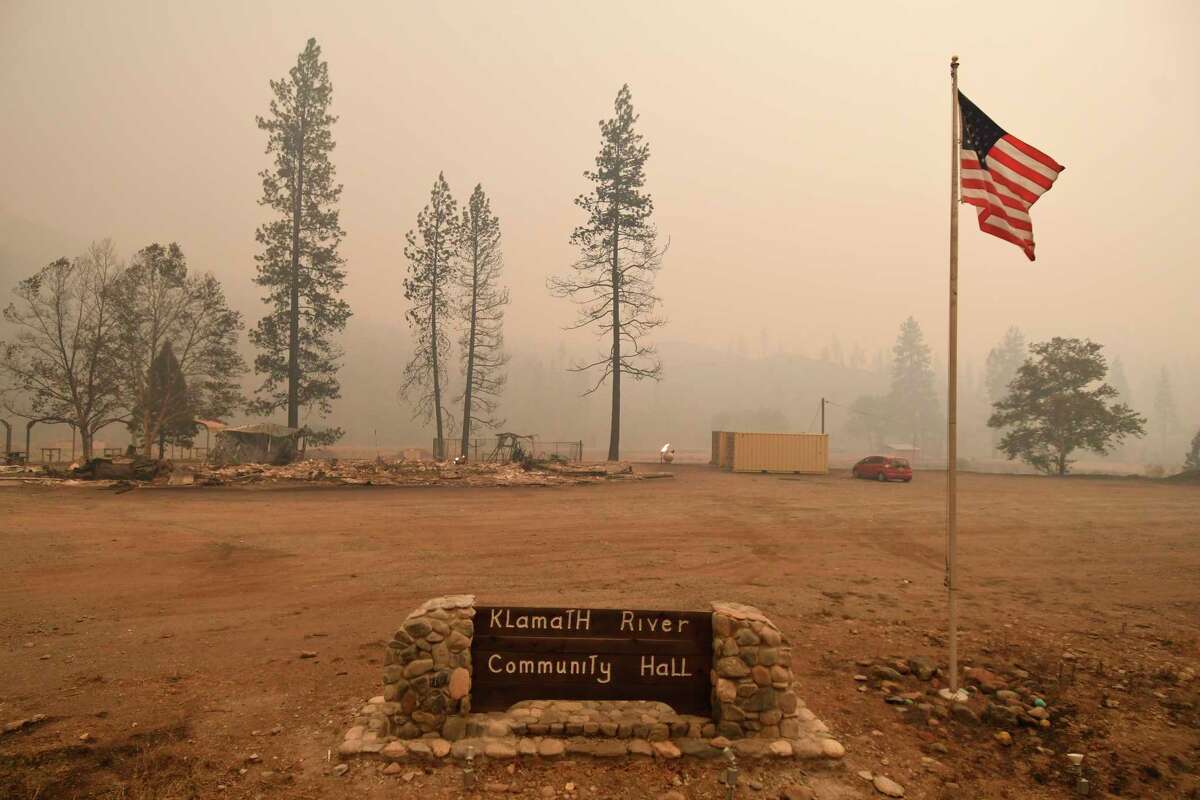
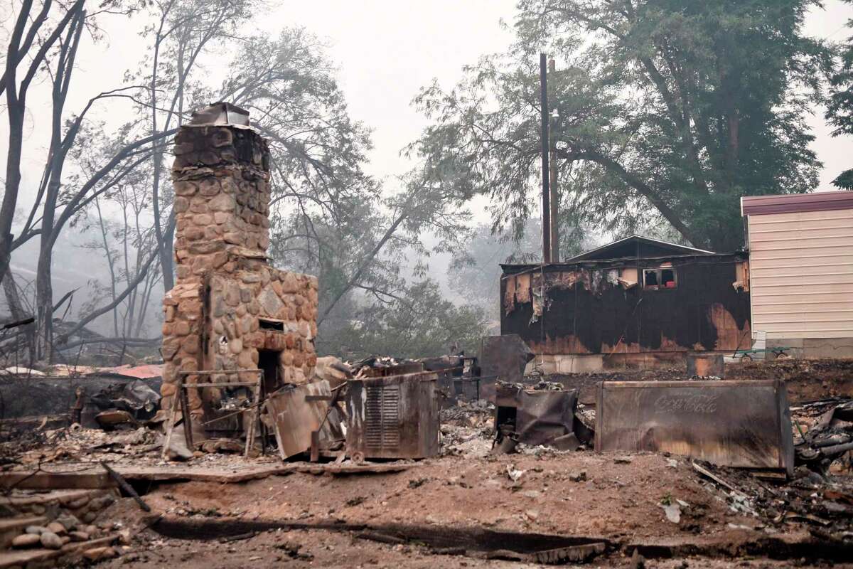
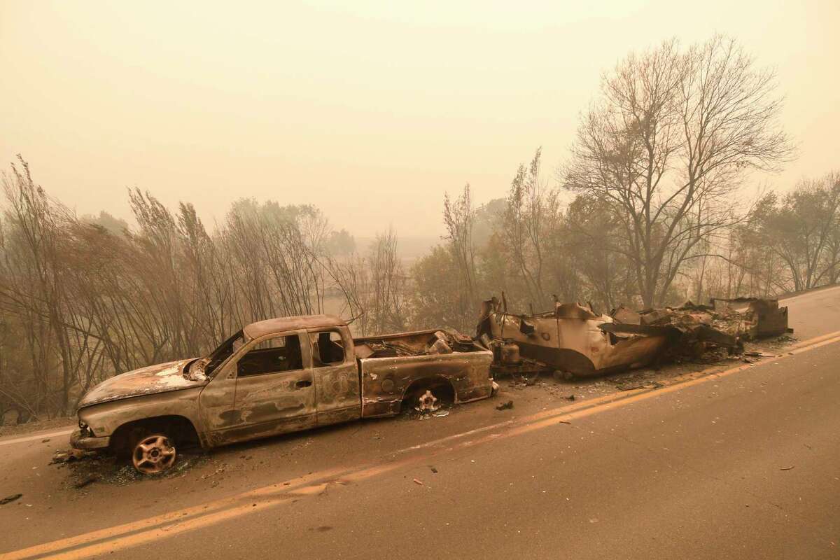
A raging wildfire along the California-Oregon border is now forcing evacuations in Yreka as high temperatures and punishing winds continue to stoke the blaze. The McKinney Fire in Siskiyou County has blackened 51,468 acres and is just 1% contained, according to the US Forest Service’s latest update Sunday morning.
“Yreka Police Department has issued an Evacuation Order for the area west of Fairchild Street and Shasta Street to include Oakridge Mobile Estates,” the Forest Service announced Saturday evening. “This area is being evacuated due to proximity to the fire and the need for additional time necessary for this group of residents to safely evacuate. Residents in the Evacuation Order area should evacuate immediately.
“An Evacuation Warning has been issued for all areas of Yreka west of I-5. Residents in the Evacuation Warning area should prepare to evacuate and should be ready if the area is changed to an order.”
Weather conditions are not favorable for fire crews. On Sunday, they’re expecting single-digit humidity, lightning, blazing temperatures and gusting winds, which “will continue to be the drivers for the extreme fire behavior.” The Forest Service expects “structure defense operations continue along the Highway 96 corridor [and] Beaver Creek community.” Over the next day, they’re projecting “fire growth… to spread in all directions as Red Flag Warning for thunderstorms and lightning are in the forecast. Fire could impact Gottville, Humbug Road area on the east flank. Movement towards Scott Bar is expected as the fire moves of Collins Baldy.”
ALSO READ: Dozens rescued from Pacific Crest Trail as McKinney Fire threatens
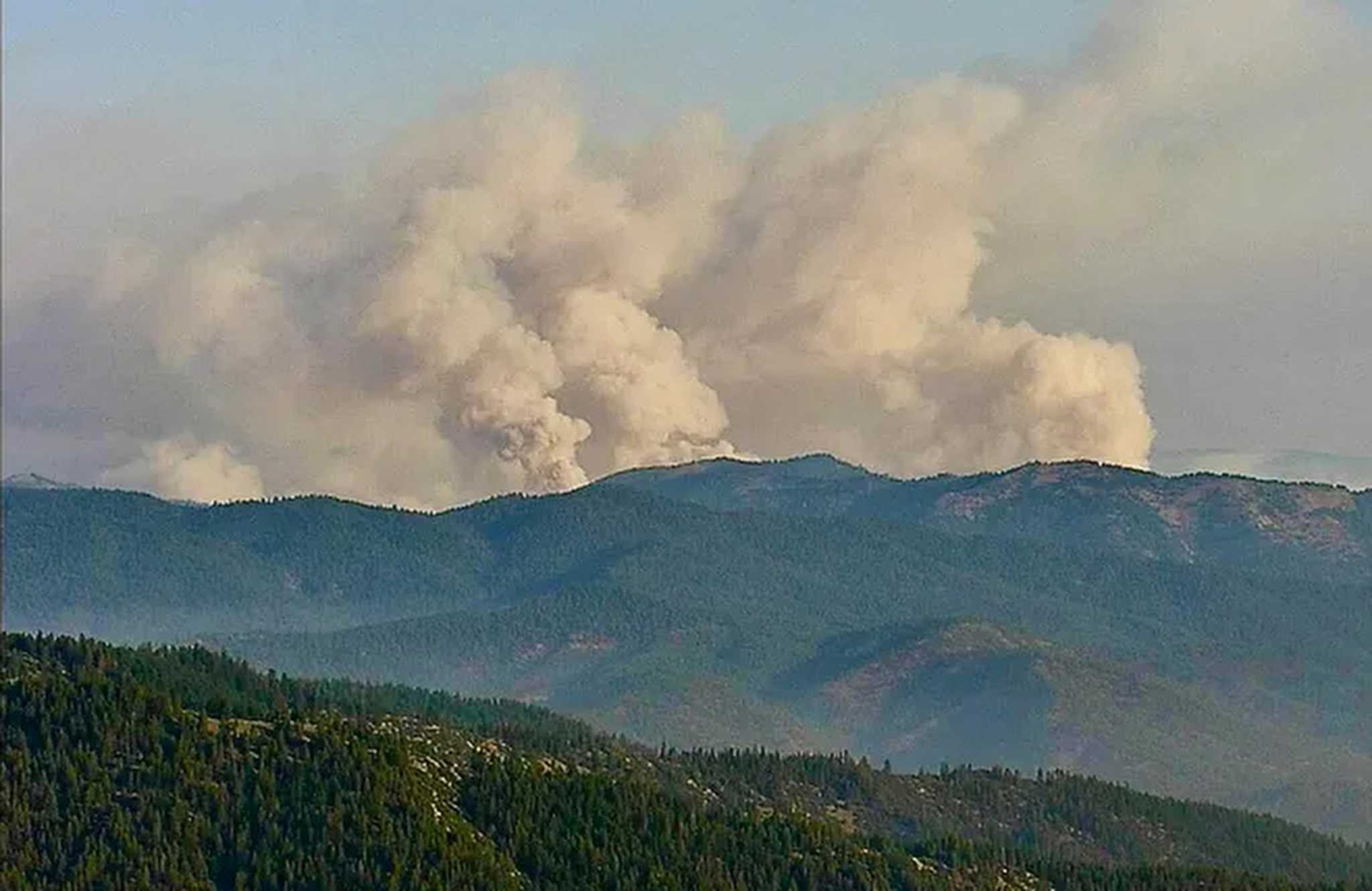
An aerial shot of the McKinney Fire burning in California’s Klamath National Forest on July 30, 2022.
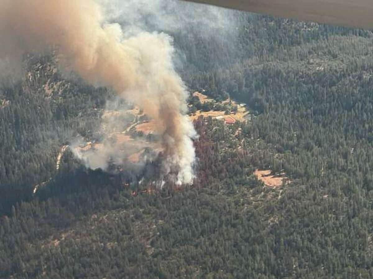
InciWebThe McKinney Fire broke out on Friday in the Klamath National Forest, about 15 miles south of the Oregon border, sending out a massive pyrocumulus cloud and triggering a flurry of evacuations in small forestland communities in the northern most part of the Golden State. The McKinney Fire was reported at 300 acres on Friday night with no containment, and exploded overnight, reaching 18,000 acres by Saturday morning, the US Forest Service said.
“Because of the erratic winds the fire is going all over the place,” Caroline Quintanilla, a public information officer with the US Forest Service, told SFGATE on Saturday afternoon.
The blaze started at 2:38 pm in the Oak Knoll Ranger District west of the Walker Creek Bridge on the south side of the Klamath River, the US Forest Service said. Thunderstorms passed over the region Friday night and may have exacerbated the blaze.”We had 100 lightning strikes in western Siskiyou County last night,” said Brad Schaaf, a meteorologist with the National Weather Service office in Medford, Ore.
“It looks like the fire definitely came first, before the thunderstorms,” Schaaf said. “It looks like there was a wind gust from the fire that aided the thunderstorm development. The first lightning strikes happened after 7 pm”
This is a carousel. Use Next and Previous buttons to navigate
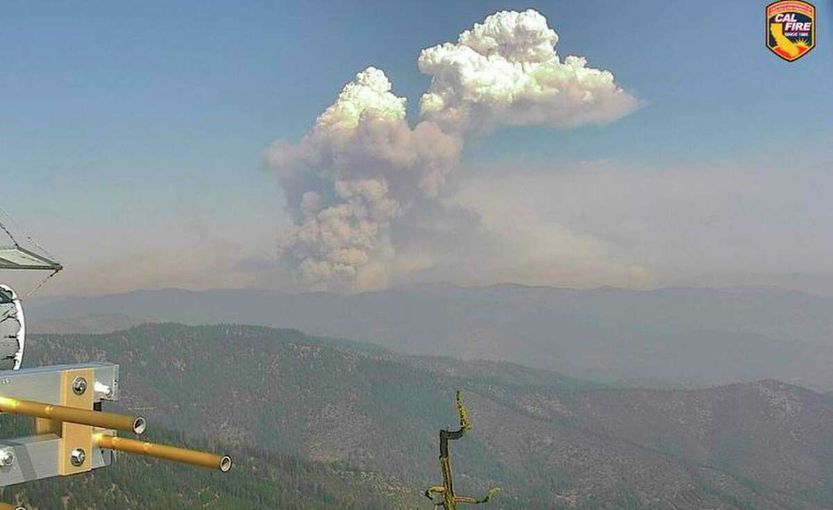
Schaaf said the fire put out a 39,000-foot-tall pyrocumulus cloud at 11:30 pm Friday. “It’s unusual for a fire to put out a fire cloud of that size late at night because usually fires stabilize after sunset,” he said.
Pyrocumulus clouds, also known as fire clouds, form when air heats up and moves upward, pushing smoke, ash and vapor up with it. They are a sign that fire activity on the ground is increasing.
Multiple roads were closed due to the blaze including Highway 96, Scott River Road, Highway 96, and Highway 263, the Siskiyou Office of Emergency Services said.
Two other smaller fires were reported near the McKinney Fire, the China Peak Fire and the Evans Peak Fire. The Klamath National Forest said at 11 am on Saturday that the China Fire had combined with the Evans Fire and was about 300 to 350 acres and 2 to 3 miles west of the town of Seiad Valley.
The Associated Press contributed to this report.