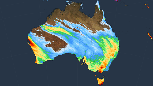
Weatherzone shared satellite images of the weather system writing, “this week’s weather will be a perfect example of how a negative Indian Ocean Dipole (IOD) affects Australia.”

Sharing images of the cloudband, Weatherzone said it is being fed by moisture-laden air from the tropical Indian Ocean.
“This stream of tropical moisture is linking up with a mid-latitude low pressure system and associated cold air mass to creating a large and thick band of cloud,” the weather service wrote.
“This type of weather pattern is common during a negative IOD and this is the second such cloudband that has affected Australia since the negative IOD was declared last week.
“After soaking parts of WA earlier this week, this cloudband will drift further east over the next few days and produce widespread cloud and rain over parts of every other state and territory in Australia.”
A negative IOD was declared last week, and is a driver of wet weather like La Nina.

Rainfall forecasts suggest up to 30mm of rain could fall over “a broad area of eastern and southeastern Australia between Thursday and Sunday”.
This could extend from central Queensland to Tasmania and South Australia.
Numerous flood warnings are already in affect for NSW and Victoria.

Rare flurry of snow dusts Western Australia
BoM defines an IOD as “the difference in sea surface temperatures between the eastern and western tropical Indian Ocean.”