The severe thunderstorm scenario for this afternoon and evening is becoming clearer. Here is the likely scenario for timing and location of the line of storms.
The new severe thunderstorm outlook is out, issued at 12:30 this Wednesday afternoon. The area for possible severe weather has been expanded southeast somewhat. Ann Arbor and the Detroit area are now also in the chance of severe thunderstorms.
Here are the latest outlines of where each type of severe weather could occur this afternoon and evening.

Overall chance of severe weather now includes most of southeast Lower Michigan.
The tornado chance now includes all of southeast and south-central Lower Michigan.

Tornado chance forecast for this afternoon and evening gives a two percent chance of a tornado within 25 miles of any point in the green shaded area.
The previous tornado forecast shown below, updated at 8:40 this morning, didn’t have southeast Lower in the area possibly affected by a tornado.

Tornado chance forecast from earlier forecast issued at 8:40 am today did not have Ann Arbor and Detroit in area
This is expected to be a line of thunderstorms, so straight-line winds are still the most likely form of severe weather.

Severe wind gust forecast for this afternoon and evening now includes Ann Arbor and Detroit.
Isolated large hail is possible, but is not expected to be a widespread type of severe weather.

Large hail forecast for this afternoon and evening has only a five percent chance of one inch hail.
Earlier it was hard to tell if we would have one, two or three lines of thunderstorms, and which line would be the severe thunderstorm line. Now as we get into early afternoon, I feel the weather picture is clearer. It appears like we will have one main line of thunderstorms, and that would also be the severe line of storms.
Here’s the latest radar forecast from the model that is best at forecasting thunderstorms in the next 12 hours.

Radar forecast from 1 pm to 10 pm today, August 3.
The scenario looks to be one line of thunderstorms that progresses southeast through this afternoon and evening. Over the last few months, these models have been an hour or two too late on forecasting the storm lines. This is probably the case here. You can take the look of the storms, but figure they could be an hour or two earlier than the model forecasts.
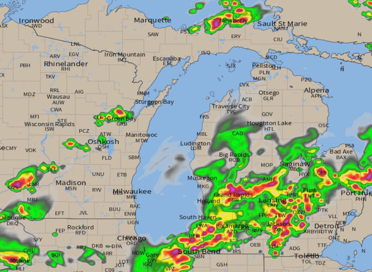
Here is the always updated radar, showing the line of storms already forming as of 1:00 pm across the middle of Lower Michigan. You can also see the line of storms becoming severe across southern Wisconsin as of 1:00 pm

Here are some estimated windows of time for the severe storms.
Grand Rapids and Muskegon to Saginaw, Bay City, Midland and the northern Thumb should be in the storms between 1 pm and 5 pm
The line of storms shifts southeast into Kalamazoo, Lansing, Jackson and Flint sometime between 3 pm and 7 pm
The severe storms then finally move into Ann Arbor, Oakland County and the entire Detroit area between 5 pm and 9 pm
An isolated tornado is possible. This is more likely what I call a “commonsense” severe weather outbreak. The line of thunderstorms could have segments of 60 mph to 65 mph wind likes. As the storms move toward your location, move into the middle of a sturdy building like a house or business. Stay away from windows as the storms move through.
Like the MLive Facebook page and allow notifications. If the weather becomes widespread severe, I will broadcast live and keep you updated on the movement and severity of the storms. Also, join the Michigan Weather Facebook group to get lesser severe weather updates in short posts.